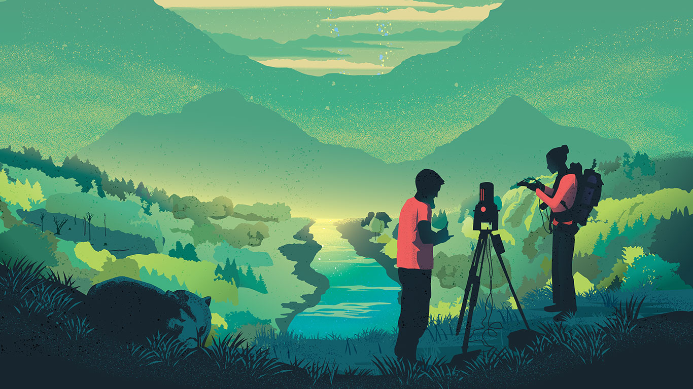
News
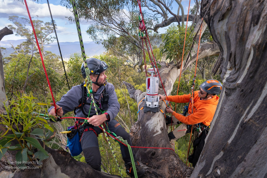
Scanning giants in Tasmania
January 2024
We had a great time in Tasmania (Australia) last December with Arko Lucieer and Leonard (University of Tasmania) mapping giant and old trees for ERC SPACETWIN. We managed to scan 10 giants (with some well over >80m height). We got great support from Steve & Jen from the tree projects, who made sure we could work with a team of professional climbers to get our RIEGL safely in the tree.
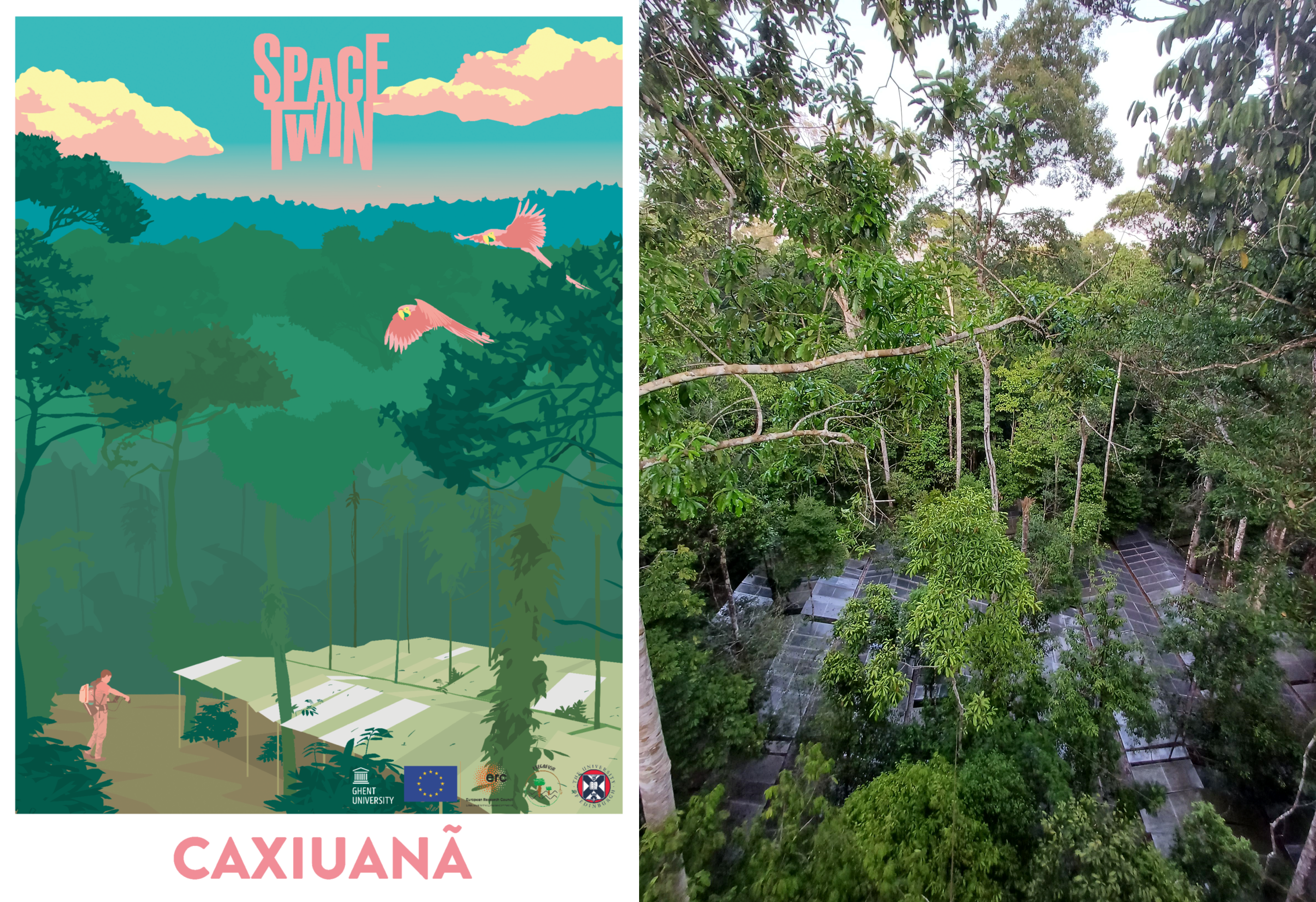
Successful field campaign to Amazon drought experiment
October 2023
Our team recently wrapped up a challenging but rewarding field campaign in Brazil's Caxiuanã National Forest. Overcoming the hurdle of a 24-hour boat journey on the Amazon, we successfully transported our pile of equipment to the field station. Armed with a terrestrial laser scanner and field spectroradiometer, we conducted 3D scans of a 1-hectare forest control and simulated drought plot, and measured the spectral properties of leaves, stems, and ground. This effort will provide us with important knowledge on how the Amazon forests will respond to increased drought stress. Stay tuned for insights from this expedition! Special thanks to the amazing individuals from Edinburgh University (UK), Universidade Federal de Para and Museu Paraense Emilio Goeldi (Brazil).
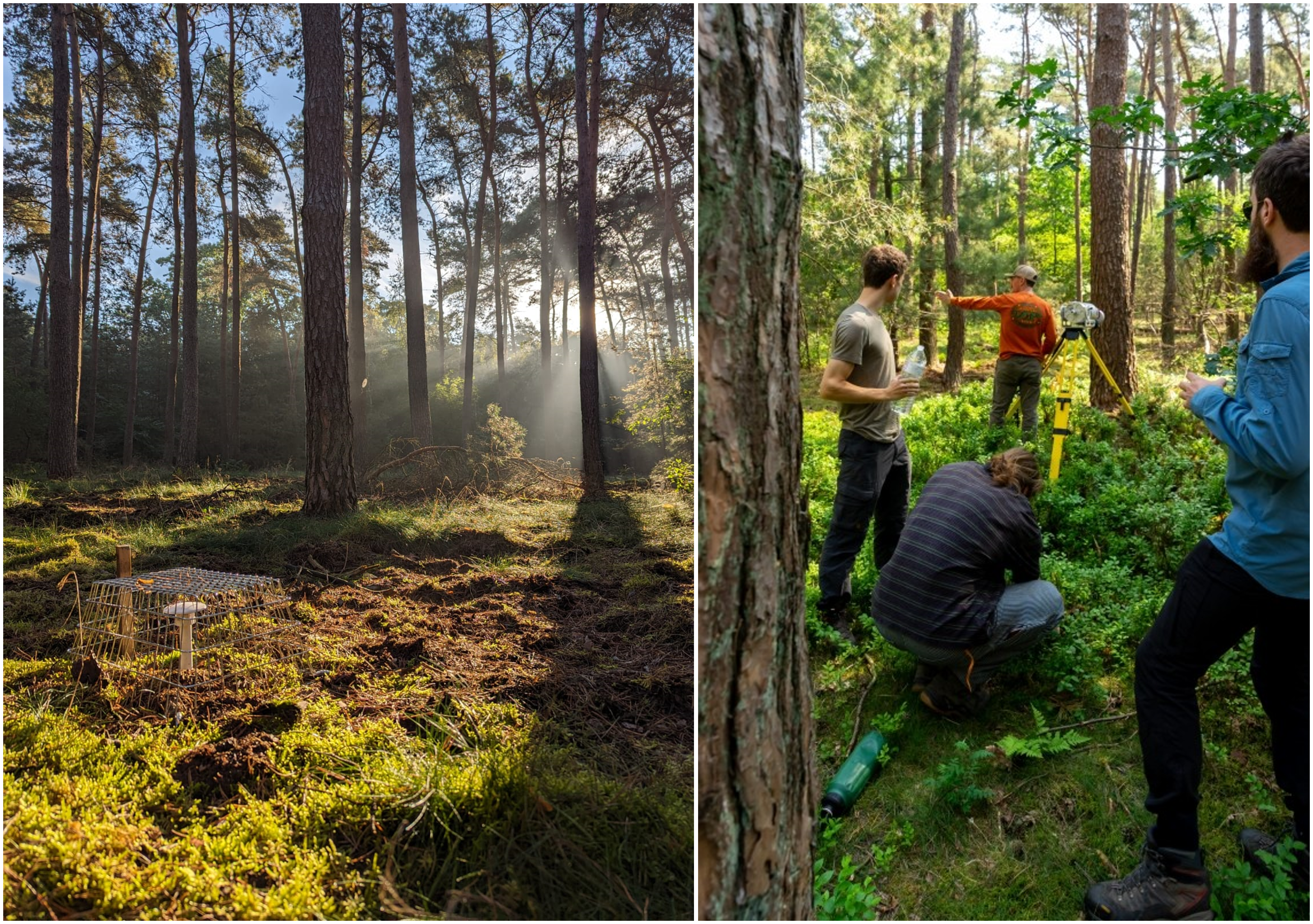
New research plots established and scanned in Bosland
September 2023
A new collaboration has been set up between CAVElab and Bosland national park (Belgium)! Over the summer, we established four new 1ha plots covering different environments within the forest. By now, the team has scanned all plots in 3D for a first time, and installed a total of 64 microclimate loggers. Learn more in this article on the Boslab website!
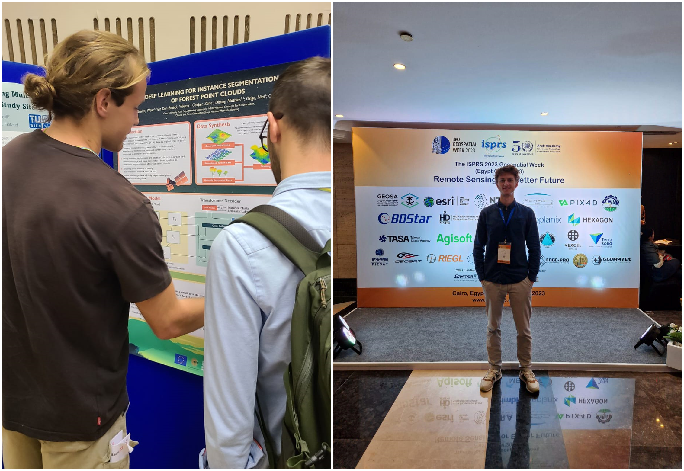
Team presents ongoing research at Silvilaser and ISPRS Geospatial Week
September 2023
During the first week of September, PI Kim Calders and PhD researchers Zane Cooper and Wout Cherlet presented their ongoing research within the SPACETWIN project at Silvilaser in London (UK). Topics included StrucNet, deep learning for instance segmentation of forest point clouds, and the validation of quantitative structure models against destructively sampled trees. At the same time, PhD researcher Wouter Van den Broeck presented his work about 'Three-dimensional deep learning for leaf-wood segmentation of tropical tree point clouds' at the ISPRS Geospatial Week in Cairo (Egypt).
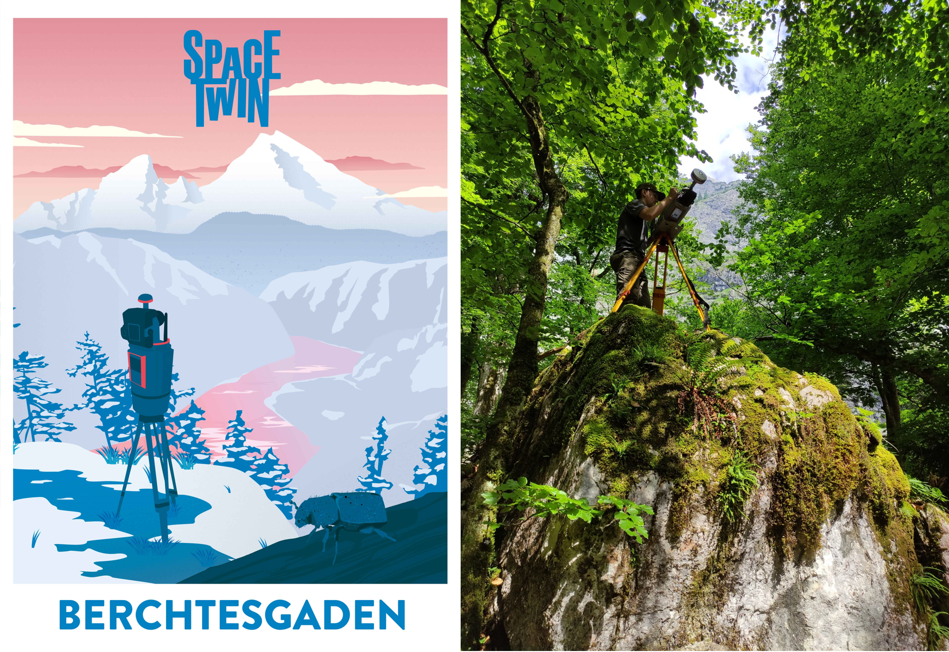
Fieldwork Berchtesgaden completed
July 2023
In collaboration with the 'Ecosystem dynamics and forest management in mountain landscapes' research team from TUM, we succesfully completed an intense fieldwork campaign in the Berchtesgaden national park (Germany). A total of four 1-hectare plots were scanned, for which the team had to cross lakes and conquer mountains. The data will be part of a multi-year dataset, allowing us to investigate forest dynamics and disturbances, including the recent bark-beetle outbreak.
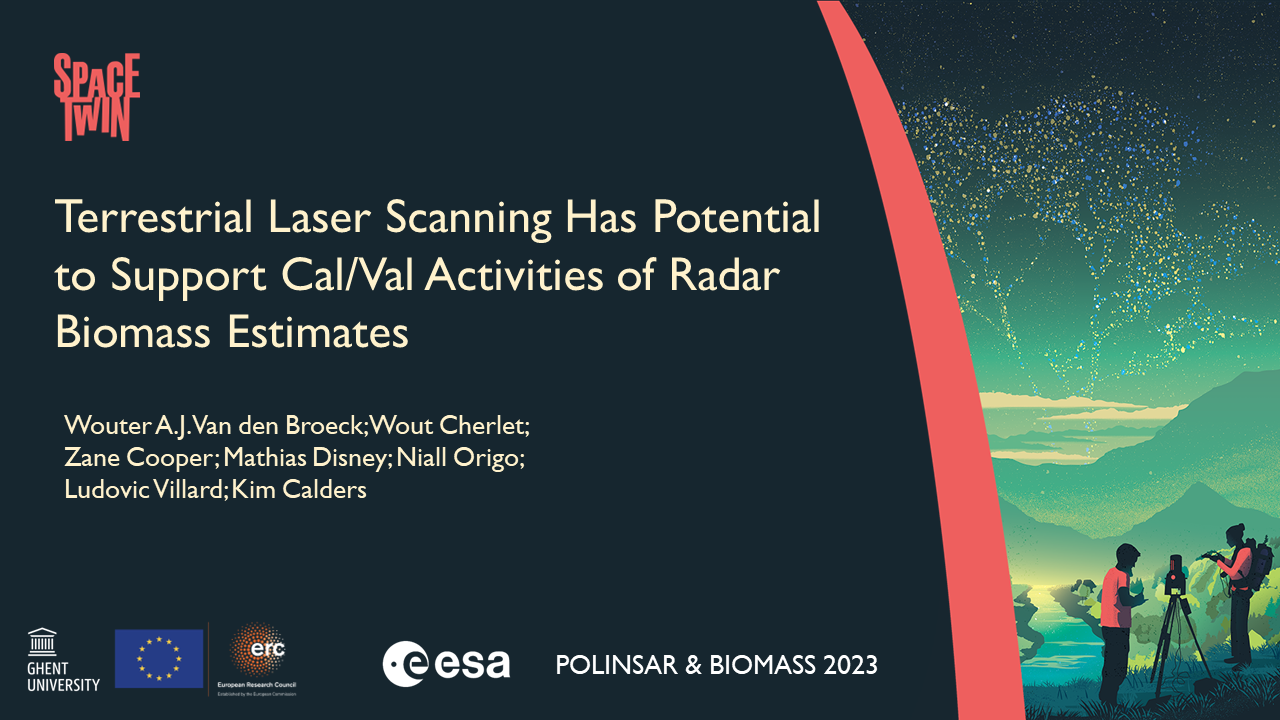
SPACETWIN project presented at ESA PolInSAR & BIOMASS
June 2023
Last week, PhD researcher Wouter Van den Broeck gave a presentation on the topic "Terrestrial Laser Scanning has Potential to Support Cal/Val Activities of Radar Biomass Estimates" at the ESA POLINSAR & BIOMASS conference in Toulouse (France). A great oppurtunity to present the SPACETWIN project to the radar-community!
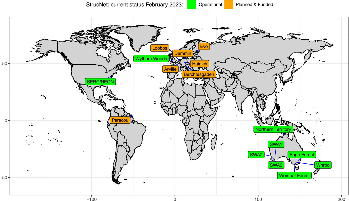
First SPACETWIN paper published
April 2023
Check out our new publication where we propose "StrucNet: A global network for automated vegetation structure monitoring": https://doi.org/10.1002/rse2.333
The team is complete!
March 2023
With the arrival of PhD researcher Zane Cooper and the start of graphic designer Kenneth Cools the core SPACETWIN team is now complete. Bring on the science!